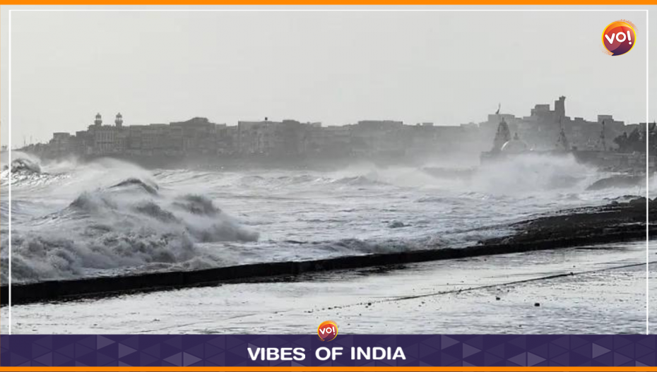
As cyclone Biparjoy advances towards the Gujarat coast, the state is on high alert. The Western Railways has already cancelled 67 trains. All necessary measures are being undertaken following standard protocols since the cyclone is bound to hit operational activities. Vibes of India has collated information to equip and educate its readers for June 15 when the cyclone is expected to make landfall.
Its status…
Moving slightly east towards the northern Gujarat coast. The cyclone’s intensity is quite severe at present, according to media outlets. This holds for any storm with winds more than167 km/hour. And this cyclone has wind intensity of200 km/hour around the centre. With sea temperature reducing, it may come down a bit. Closer to the Kutch coast, the damage could be greater.
Where is it going to make landfall?
Likely to be between Lakhpath (north of Kutch) and Mandvi (south of Kutch). The forecast is that it will make landfall near Jakhau Port in Gujarat on June 15. A Kolkata daily has reported that approximately 7,500 people have moved to safety. Fishermen have been advised to stay away from the sea. Jamnagar, Devbhumi Dwarka, Porbandar, Junagadh and Morbi are already evacuating people.
What to expect during the landfall?
Expect wind speeds of about 100 km/hour plus. There could be strong winds in the range of 100-130 km/hour for six to eight hours on June 15. Transport services will be hit. That said, Kutch doesn’t have a broad railway network in any case. The temperature will come down to roughly 30 degrees.
Plan of action…
- Protect your assets.
- Move to safer places.
- Shift to different areas if you’ve been living in old buildings.
- Plan for damages.
- Telecom towers remain vulnerable.
- Be prepared for power failures.
- Store water.
- Trim trees.
- Clear water-logging.
What you must do after the landfall and the cyclone’s intensity reduces…
- Wait for the flood waters to recede.
- Low-lying areas will be flooded — take those affected to safe places
- Connectivity will be disrupted, so stock food for a few days.
Cyclones, like many upheavals in our lives, are a kind of examination conducted by nature. It’s a chance to assess our preparedness. Not panic but peace and service to the affected should be the aim.
Read Also: Cyclone Biparjoy: Dwarka And Kutch at High Risk, Says IMD


